Bank Information
Bank
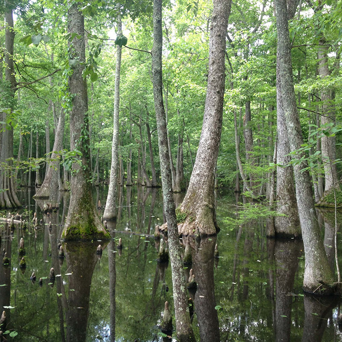
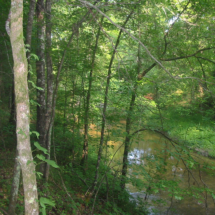
Ace Basin
State
South Carolina
Primary HUC
03050206
Primary Service Area
Edisto
Primary HUC
03050203
Primary Service Area
North Fork Edisto
Primary HUC
3050204
Primary Service Area
South Fork Edisto
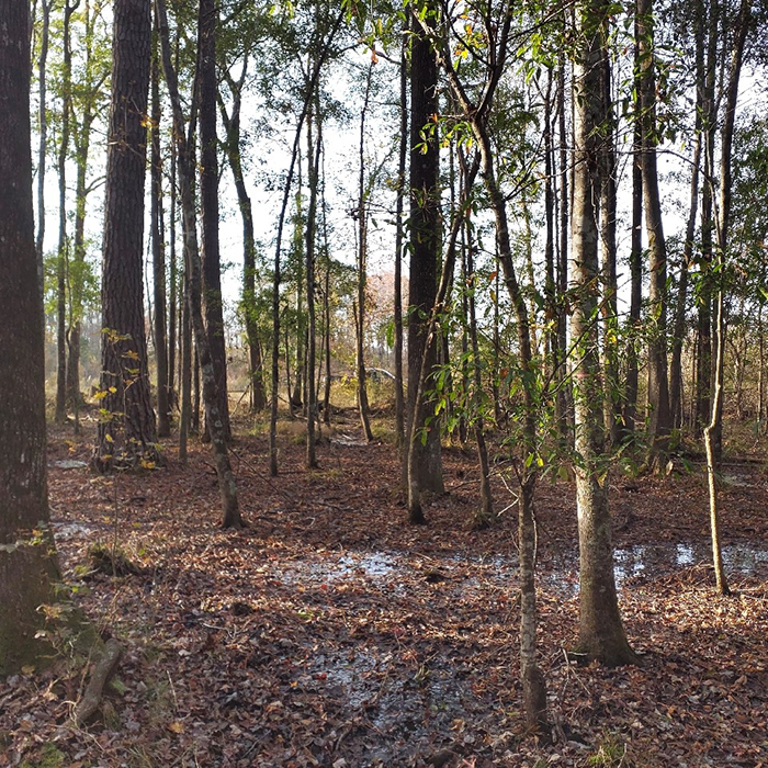
ACE Basin is a pending mitigation bank in Colleton County, comprised of approximately 2,051 acres. The site will result in the restoration, enhancement and/or preservation of approximately 1,411 acres of freshwater wetlands and over 9,400 linear feet of streams.
Bank
Bachelors Delight
State
North Carolina
Primary HUC
03030001 (excludes 040005, 040010 and 040020)
Primary Service Area
White Oak
Bachelors Delight is a stream and wetland mitigation bank in Onslow County and spans 363 acres. The overarching goals of the bank are to enhance water quality; to increase flood attenuation; and to improve aquatic, semi-aquatic and terrestrial habitat of streams and wetlands.
Bank
Big Run
State
South Carolina
Primary HUC
03050201
Primary Service Area
Cooper
The Big Run Wetland is the first mitigation site for the Palmetto Umbrella Mitigation Bank. It is located in Berkeley County and comprises 2,367 acres. Mitigation efforts on the site will result in the restoration, enhancement and/or preservation of approximately 1,820 acres of wetlands and over 60,000 linear feet of streams.
Bank
Brice Creek
State
North Carolina
Primary HUC
03020204
Primary Service Area
Lower Neuse
The Brice Creek Mitigation Bank is located in Craven County and is a bottomland hardwood bank comprised of 473 acres. The bank is enhancing 163 acres of intensively managed pine plantations to native non-riparian wet and swamp bottomland hardwood forest.
Bank
Broxton Rocks
State
Georgia
Primary HUC
03070102
Primary Service Area
Lower Oconee
Primary HUC
03070105
Primary Service Area
Little Ocmulgee
Primary HUC
03070104
Primary Service Area
Lower Ocmulgee
Primary HUC
03070106
Primary Service Area
Altamaha
Primary HUC
03070203
Primary Service Area
Cumberland-St. Simons
The Broxton Rocks Mitigation Bank is located in Coffee and Jeff-Davis Counties comprising 1,591 acres. The bank is enhancing 116 acres of wetlands while preserving approximately 81 acres of existing wetland habitat within the floodplain of the Ocmulgee River. It will also restore approximately 2,880 linear feet of stream channel while restoring and preserving approximately 41,126 linear feet of riparian buffer.
Bank
CHICORA
State
South Carolina
Primary HUC
03050201
Primary Service Area
Cooper
Chicora is a pending mitigation site for the Palmetto Umbrella Mitigation Bank. It is located in Berkeley County and comprises 2,021 acres. Mitigation efforts on the site will result in the restoration, enhancement and/or preservation of approximately 1,900 acres of wetlands and over 43,199 linear feet of streams.
Bank
COTTON VALLEY
State
Louisiana
Primary HUC
11140203
Primary Service Area
Loggy Bayou
Primary HUC
11140209
Primary Service Area
Black Lake Bayou
The Cotton Valley Mitigation Bank is located in Webster Parish and is a bottomland hardwood and stream mitigation bank comprised of 678 acres. The bank is restoring 206 acres of wetland and 20 acres of upland buffer. It enhances 87 acres of wetland from intensively managed pine plantations to native bottomland hardwood, along with preserving 259 acres of bottomland hardwood. The bank will also enhance 68 acres, or 18,696 linear feet of stream, along Bayou Dorcheat.
Bank
CROW BAY
State
South Carolina
Primary HUC
03040205
Primary Service Area
Black
The pending Crow Bay Mitigation Site is another mitigation site to be added to the Palmetto Umbrella Mitigation Bank. It is located in Clarendon County and comprises approximately 978 acres. Mitigation efforts on the site will result in the restoration, enhancement and/or preservation of approximately 520 acres of freshwater wetlands and over 13,000 linear feet of streams.
Bank
Denton Bottoms
State
Louisiana
Primary HUC
08040303
Primary Service Area
Dugdemona
Primary HUC
08040304
Primary Service Area
SA Little
The Denton Bottoms Mitigation Bank is located in Jackson and Bienville Parishes and is a bottomland hardwood and stream mitigation bank comprised of 252 acres. The bank is restoring 167 acres of intensively managed, bedded pine plantations to native bottomland hardwood forest. In addition, 34 acres of existing bottomland hardwood forest, 20 acres of upland buffer and 30.54 acres of riparian buffer along 8,971 linear feet of stream are being preserved.
Bank
Dolly T
State
Louisiana
Primary HUC
03180004
Primary Service Area
Lower Pearl
Primary HUC
03180005
Primary Service Area
Bogue Chitto
The Dolly T Mitigation Bank is located in St. Tammany Parish and is comprised of eastern longleaf pine savannah and slash pine flatwoods that encompass 1,473 acres. In addition to restoring 1,159 acres of intensively managed pine, the bank also enhances or preserves 215 acres of existing bayhead swamp wetlands, 69 acres of cypress/ hardwood flat wetlands and 30 acres of uplands.
Bank
Great Bear
State
Arkansas
Primary HUC
08040202
Primary Service Area
Lower Quachita-Bayou De Loutre
Primary HUC
08040201
Primary Service Area
Lower Quachita-Smackover
The Great Bear Mitigation Bank is a bottomland hardwood bank located in Ashley County and comprised of 514 acres. The bank is restoring 439 acres of bedded pine plantations to native bottomland hardwoods, along with 51 acres of upland buffer, to a mixed pine and hardwood forest. In addition, 17 acres of existing bottomland hardwood forest are being preserved.
Bank
Great Swamp
State
South Carolina
Primary HUC
03050207
Primary Service Area
Salkehatchie River
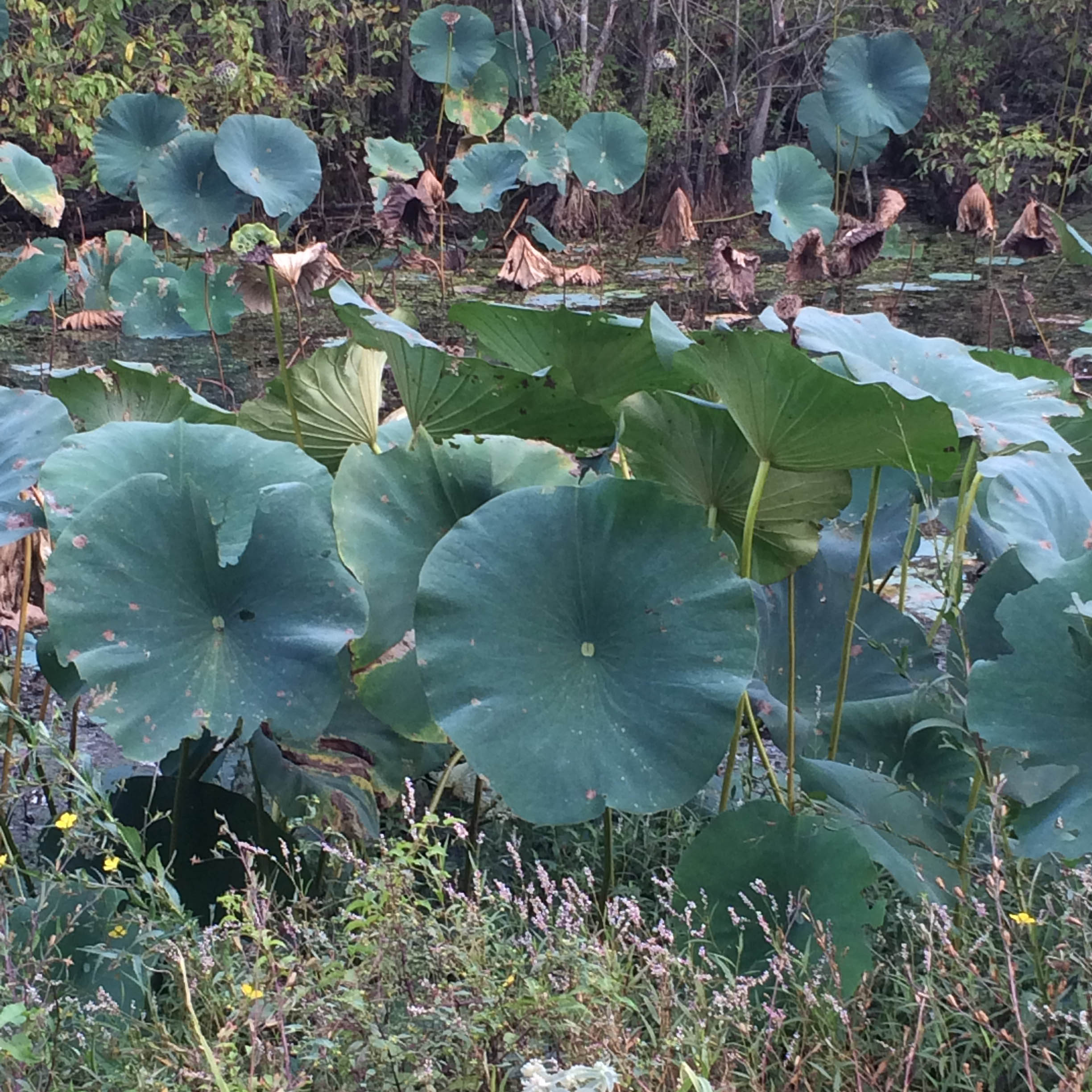
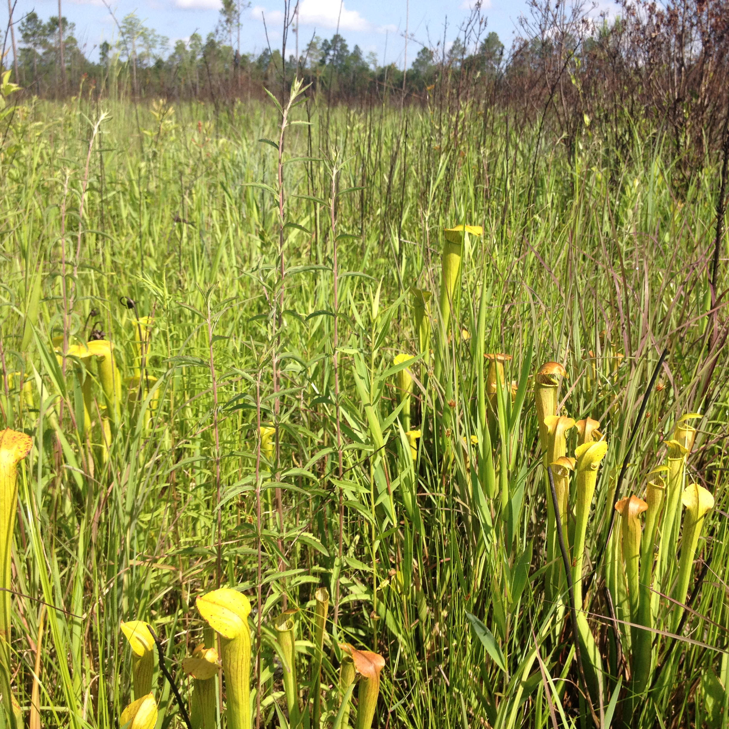
The Great Swamp Mitigation Site is another site in the Palmetto Umbrella Mitigation Bank. It is located in Colleton County and comprises approximately 3,067 acres. The site is located within the headwaters of the Ashepoo River, which is in a sub-basin of the Salkehatchie River Basin. This 91,357-acre watershed includes Jones Swamp Creek and Doctors Creek, which form the Great Swamp. Great Swamp joins Ireland Creek to form the Ashepoo River. The site is unique in that it contains many historical rice fields. Mitigation efforts will result in the restoration, enhancement and/or preservation of approximately 1,411 acres of freshwater wetlands and 50,000 linear feet of streams.
Bank
Gregorys Creek
State
South Carolina
Primary HUC
03050106
Primary Service Area
Lower Broad
The Gregorys Creek Mitigation Site is the second mitigation site for the Palmetto Umbrella Mitigation Bank. It is located in Union County and comprises approximately 532 acres. Mitigation efforts on the site will result in the restoration, enhancement and/or preservation of approximately 171 acres of freshwater wetlands and over 53,371 linear feet of streams.
Bank
GRIFFINS CREEK
State
South Carolina
Primary HUC
03050110
Primary Service Area
Congaree
The pending Griffins Creek site is part of the Palmetto Umbrella Mitigation Bank in Richland County, encompassing 1,341 acres. Approximately 1,323 acres are available for the restoration, enhancement and/or preservation of freshwater wetlands.
Bank
Gum Swamp
State
Louisiana
Primary HUC
08070202
Primary Service Area
Amite
PRIMARY HUC
08070203
Primary Service Area
Tickfaw
PRIMARY HUC
08070204
Primary Service Area
Lake Maurepas
PRIMARY HUC
08070205
Primary Service Area
Tangipahoa
PRIMARY HUC
08090201
Primary Service Area
Liberty Bayou-Tchefuncta
PRIMARY HUC
08090202
Primary Service Area
Lake Pontchartrain
PRIMARY HUC
08090203
Primary Service Area
Eastern Louisiana Coastal
The Gum Swamp Mitigation Bank is located in Livingston Parish and is a bottomland hardwood mitigation bank encompassing 1,125 acres. The bank is restoring 1,035 acres of intensively managed, bedded pine plantations to native bottomland hardwood forest. In addition, 62 acres of existing bottomland hardwood forest and 18 acres of uplands are being preserved.

Bank
Long Lonesome
State
Louisiana
Primary HUC
08040202
Primary Service Area
Lower Quachita-Bayou De Loutre
Primary HUC
08040206
Primary Service Area
Bayou D'arbonne
The Long Lonesome Mitigation Bank is located in Morehouse Parish and is a bottomland hardwood bank comprised of 613 acres. The bank is restoring 552 acres of intensively managed, bedded pine plantations to native bottomland hardwood forest. In addition, 46 acres of existing bottomland hardwood forest and nine acres of uplands are being preserved.
Bank
Middle Neuse
State
North Carolina
Primary HUC
03020202
Primary Service Area
Middle Neuse
The pending Middle Neuse Umbrella Mitigation Bank is located in both Beaufort and Craven counties, comprising approximately 344 acres. Mitigation efforts will result in the restoration, enhancement and/or preservation of approximately 57 acres of freshwater wetlands and over 31,000 linear feet of streams.
Bank
Ogeechee River
State
Georgia
Primary HUC
03060201
Primary Service Area
Upper Ogeechee
PRIMARY HUC
03060202
Primary Service Area
Lower Ogeechee
PRIMARY HUC
03060203
Primary Service Area
Canoochee
PRIMARY HUC
03060204
Primary Service Area
Ogeechee Coastal
PRIMARY HUC
03070107
Primary Service Area
Ohoopee
Ogeechee River is a pending freshwater riverine and slope wetlands bank in Screven County, covering approximately 3,698 acres. The site will result in the restoration, enhancement and/or preservation of approximately 3,137 acres of freshwater riverine and slope wetlands and over 7,400 linear feet of streams.
Bank
PONTCHARTRAIN BASIN UMBRELLA MITIGATION BANK
State
Louisiana
Primary HUC
08070202
Primary Service Area
Amite
PRIMARY HUC
08070203
Primary Service Area
Tickfaw
PRIMARY HUC
08070204
Primary Service Area
Lake Maurepas
PRIMARY HUC
08070205
Primary Service Area
Tangipahoa
PRIMARY HUC
08090201
Primary Service Area
Liberty Bayou-Tchefuncta
PRIMARY HUC
08090202
Primary Service Area
Lake Pontchartrain
PRIMARY HUC
08090203
Primary Service Area
Eastern Louisiana Coastal
The Pontchartrain Basin Umbrella Mitigation Bank is located in Livingston Parish, spanning approximately 7,385 acres. Mitigation efforts will result in the rehabilitation, enhancement and preservation of hardwood and flatwood forested wetland ecosystems as described by the Louisiana Department of Wildlife and Fisheries Natural Heritage Program (LNHP 2009).
Bank
SAVANNAH BRANCH
State
South Carolina
Primary HUC
03060110
Primary Service Area
Calibogue Sound-Wright River
The Savannah Branch Mitigation Bank is part of the Palmetto Umbrella Mitigation Bank in Jasper County. With approximately 2,137 acres, the bank’s purpose is to restore, enhance and/or preserve approximately 1,600 acres of freshwater wetlands and over 16,000 linear feet of streams.
Bank
St. Johns
State
Florida
Primary HUC
30801031601
Primary Service Area
Broward River
Primary HUC
308010315
Primary Service Area
Trout Creek-St. Johns River
Primary HUC
308010314
Primary Service Area
Ortega River-St. Johns River
Primary HUC
30801031602
Primary Service Area
Big Island Swamp
Primary HUC
30801031604
Primary Service Area
Upper Pablo Creek
Primary HUC
308010310
Primary Service Area
North Fork of Black Creek
Primary HUC
308010309
Primary Service Area
South Fork of Black Creek
Primary HUC
308010311
Primary Service Area
Black Creek-St. Johns River
Primary HUC
308010313
Primary Service Area
Doctors Lake-St. Johns River
Primary HUC
308010312
Primary Service Area
Palmo Cove-St. Johns River
Primary HUC
308010308
Primary Service Area
Clarks Creek-St. Johns River
The St. Johns Mitigation Bank is a 3,580-acre site located in St. Johns County. Mitigation efforts used to restore the historic conditions of the bank focus on the enhancement of approximately 3,110 acres of mesic flatwoods, wet flatwoods, basin swamp, bottomland hardwoods and approximately 430 acres of uplands.
Bank
Turkey Creek
State
Mississippi
Primary HUC
Six coastal counties of Mississippi located in Mobile District
Primary Service Area
Pearl River, Stone, George, Jackson, Harrison and Hancock counties
The Turkey Creek Mitigation Bank services the six coastal counties and is comprised of wet pine savannah and bottomland hardwood wetlands encompassing approximately 238 acres. In addition to restoring 158 acres of intensively managed pine plantation back to wet pine savannah, 20 acres of existing bottomland hardwoods and 50 acres of upland pine savannah are also being enhanced or preserved.
Bank
Tusculum
State
Georgia
Primary HUC
03060106
Primary Service Area
Middle Savannah
Primary HUC
03060108
Primary Service Area
Brier
Primary HUC
03060109
Primary Service Area
Lower Savannah
Tusculum is a pending mitigation bank in Effingham County, spanning approximately 740 acres. Mitigation efforts on the site will result in the enhancement and preservation of approximately 595 acres of slope wetlands.
By using this website, you agree to our Privacy Policy. California residents: See our CCPA Privacy Notice for details on what personal information we collect and for what purposes.